A study against the weather record
Winslow Homer
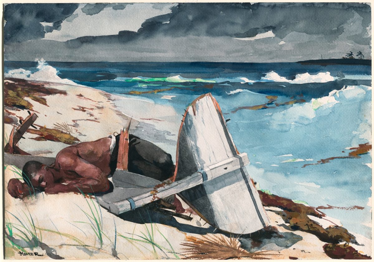
After the Hurricane, Bahamas
The title says a hurricane had passed. Was there one while Homer was in the Bahamas?
Hurricane unknown
The Nephos method
How this study was read
The method in fullWhat is written
The Bahamas, in the winter of 1898–99 as the museum dates Homer’s visit; signed 1899. The title names a hurricane.
Homer 99
Signature, lower left, as the Art Institute of Chicago transcribes itAfter the Tornado
Pencil inscription on the back, lower left, as the Art Institute of Chicago transcribes it; the hand is not identifiedThis compelling watercolor was painted during Homer’s second trip to the Bahamas in the winter of 1898–99.
Art Institute of Chicago, 1933.1235Here sunlight glints through gradually thinning storm clouds.
Art Institute of Chicago, 1933.1235
Records of those days
- HURDAT2, the Atlantic hurricane recordNOAA’s reconstructed track of every known Atlantic tropical storm and hurricane, position and wind every six hours. Every 1898 and 1899 storm measured against Nassau.
- O. L. Fassig, Climate of the Bahama Islands (1905)Nassau observations of 1898–1902 from the Bahamas Cable Office, printed as averages and extremes, and James Page’s 1901 account of the September 1898 hurricane.
Not found or not yet searched
- The daily Nassau register kept at the Bahamas Cable Office was summarised by Fassig but not printed day by day, and has not been found.
- No open source found gives the month Homer arrived in or left the Bahamas.
- Nassau newspapers for the winter have not been searched.
Each claim tested
- “After the Hurricane”. NOAA’s hurricane database (HURDAT2) records no tropical storm or hurricane anywhere in the Atlantic between 4 November 1898 and 26 June 1899. Five storms passed within 500 km of Nassau from August to October 1898; the strongest there, a hurricane of 95 knots, stayed 381 km away on 30 September.
- Page’s hurricane of 26 September 1898. Fassig quotes Page on a hurricane “of small area but of great intensity” west of Eleuthera on 26 September and at Great Abaco by the 27th. The only storm HURDAT2 places in the Bahamas those days passes Great Abaco on the 27th but is rated no more than 45 knots, a tropical storm, and comes no nearer Nassau than 173 km.
- “After the Tornado”. HURDAT2 does not record tornadoes, and the Fassig passages read for this study do not mention one.
- “gradually thinning storm clouds”, the museum’s reading of the sky. Fassig prints Nassau’s weather only as five-year averages and extremes. Thunderstorms averaged 0 in December, 0.8 in January and 0.6 in February, 1898–1902.
Verdict
The winter was quiet: NOAA’s hurricane database records no tropical storm or hurricane anywhere in the Atlantic between 4 November 1898 and 26 June 1899.
- Unknown“After the Hurricane” The storms nearest Nassau came in September and October 1898, before the winter the museum gives; which storm, if any, the title means cannot be shown.
- Unknown“After the Tornado” No record read for this study covers tornadoes.
- Unknown“gradually thinning storm clouds” No day’s sky at Nassau that winter is on record.
- UnknownThe day painted. The museum gives a winter, not a day.
What this cannot tell you. Storm positions for 1898–99 are modern reconstructions from ship and coast reports; a small storm far from shipping could be missing. Distances are to a storm’s centre, not the wind felt on a beach. The museum names the Bahamas, not an island; Nassau stands in because its record is the one Fassig published. A winter gale is not a tropical storm and would not appear in HURDAT2.
Step 2 · Records of those days
Every storm of 1898 and 1899
NOAA’s hurricane database (HURDAT2) gives the centre of every known tropical storm and hurricane every six hours. Each line is one storm; its lowest point marks the closest it came to Nassau. 21 are recorded across the two years; none between 4 November 1898 and 26 June 1899.
- a 27 September 1898, 173 km: a tropical storm of 45 knots. Page reports a hurricane near Great Abaco that day.
- b 12 August 1899, 67 km: a hurricane of 105 knots, the storm Page calls the “Porto Rican hurricane”.
Step 3 · The claim tested
The 10 that came within 500 km
The other 11 passed farther away. Every storm that came within 500 km fell between late July and mid-November, before or after the winter the museum gives.
| Date of closest approach (UTC) | Distance | Strength there | Wind there | Peak wind on its track |
|---|---|---|---|---|
| 2 August 1898 | 268 km | tropical storm | 35 kt | 70 kt |
| 27 September 1898 | 173 km | tropical storm | 45 kt | 45 kt |
| 30 September 1898 | 381 km | hurricane | 95 kt | 115 kt |
| 11 October 1898 | 214 km | tropical storm | 60 kt | 60 kt |
| 23 October 1898 | 145 km | no longer tropical | 35 kt | 40 kt |
| 4 November 1898 to 26 June 1899: no tropical storm or hurricane recorded anywhere in the Atlantic | ||||
| 30 July 1899 | 252 km | tropical storm | 40 kt | 85 kt |
| 12 August 1899 | 67 km | hurricane | 105 kt | 130 kt |
| 15 October 1899 | 52 km | tropical depression | 30 kt | 40 kt |
| 30 October 1899 | 136 km | hurricane | 75 kt | 95 kt |
| 10 November 1899 | 267 km | tropical depression | 30 kt | 55 kt |
Step 3 · The claim tested
What a Weather Bureau climatologist printed in 1905
Oliver Fassig wrote the climate chapter of The Bahama Islands from the Nassau record of 1898 to 1902, the years around Homer’s visit. His September chart of hurricane tracks puts Nassau in their path; his text says when they come.
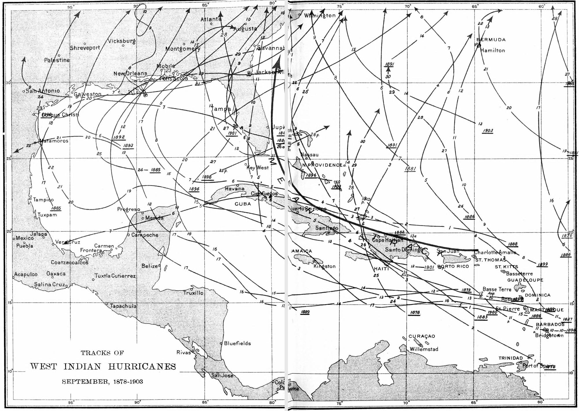
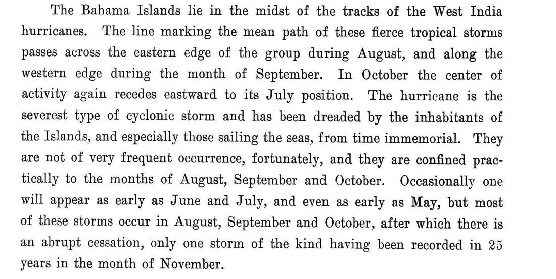
“On the morning of September 26, 1898, a hurricane of small area but of great intensity was discovered, central to the west of Eleuthera.”
James Page, 1901, quoted by Fassig, page 122
“The lowest temperature recorded during the five-year period under consideration was 53°, which occurred on the 14th day of February, 1899.”
Fassig, page 114. The coldest reading of his five years, 53 °F (11.7 °C), fell in Homer’s winter.
Average thunderstorms at Nassau, 1898–1902: December 0, January 0.8, February 0.6, against 7.2 in August.
Fassig, page 120, table
Step 4 · Why the verdict is Unknown
A title, not a date
The record finds no storm during the winter itself, and that cannot settle a title. It could mean the autumn storms, a storm Homer was told about, or no particular storm; nothing on record decides between them. The Metropolitan Museum dates his watercolour Hurricane, Bahamas to 1898; the last tropical storm of 1898 in NOAA’s record ended on 4 November 1898.
Sources
Every source on this page
Each file was downloaded and given a fingerprint (its sha256). The page is rebuilt from these files and will not build if a fingerprint changes, so every number above comes from them rather than being typed in.
- NOAA National Hurricane Center, HURDAT2 Atlantic best track, 1851–2025
sha256 df63fabce0ad824d20447e241bd27a2a65ae36cb2f9b62aa3caacd9171c34f11 - Art Institute of Chicago, After the Hurricane, Bahamas, 1933.1235
sha256 5e3ddb15ed2953141605229dc429d56ab4e6f257fa959f3076b9a74594bc5581 - O. L. Fassig, “Climate of the Bahama Islands”, in G. B. Shattuck (ed.), The Bahama Islands (1905)
sha256 e3600ca761cdb1be652888e48533d33dcefbbc8d9e769e27fc38c497fb08c037 - The Metropolitan Museum of Art, Winslow Homer, Hurricane, Bahamas, 10.228.7
sha256 85f522c33dea62ec2c75a5147a1128a90c722f6736a7611ce8b2a3fb502a4e25
Look closer
Why does the storm still feel present?
A close reading of the clouds, waves and wreckage in the watercolour itself. It reads the picture; this page tests what is written about it.